★★★★☆ | Moderate to very difficult options | Trail, via ferrata & rock climbing possibilities |
The Tour d’Aï and its neighbour, the Tour de Mayen, form distinctive rocky camel humps on the Vaud skyline. Located near Leysin in Switzerland, Tour d’Aï makes for an fun day hike in the Lake Geneva region — with plenty of more difficult options if that’s what you prefer!
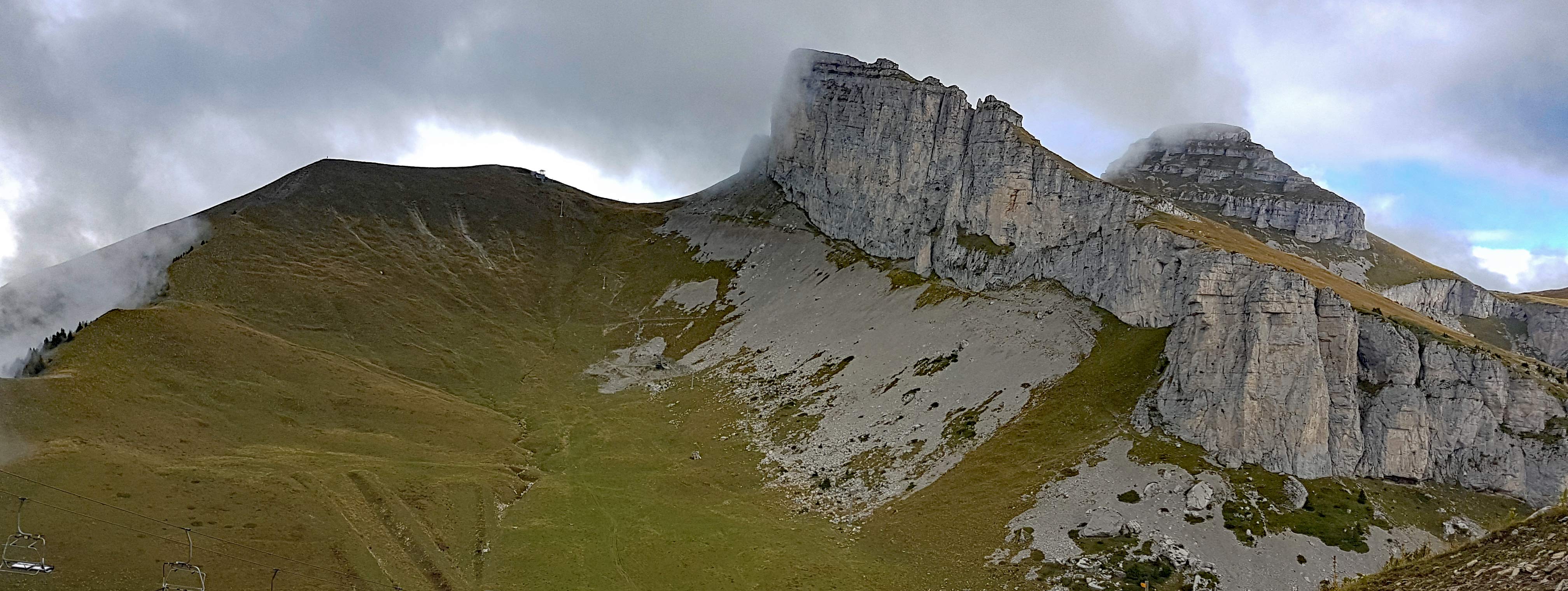
One side of the Tour d’Aï is a sheer cliff, while the other is a gentler grassy slope. You can reach the top via both. The cliff side is, obviously, vertical and very exposed — but made easier with a via ferrata. From the top you have fabulous views of Lake Geneva, the Alps and the wide Rhône valley in Valais. On a good day, that is — I’ve done this hike twice and both times we mainly saw mist. But even without the view, it’s still a lovely hike.
Hiking trail info – Tour d’Aï
All options start and end in the ski resort town of Leysin (46.347610, 7.017399), which is served by public transport and has many eating and sleeping options.
The well-marked trail is not too steep or exposed. A couple of sections have chains and ladders. I wouldn’t recommend it during or after rain, though, as the well-worn rocks can get very slippery. This true for both the via ferrata and the trail.
The via ferrata route is rated as “difficult” and includes a chimney climb in one place and slight overhang in another. However I only found the first few steps really hard as there don’t seem to be enough handholds. Afterwards the climb is straightforward. Still, you wouldn’t want to attempt it if you have a fear of heights. Kai (10 years old and not yet 150 cm tall at the time) was a little short to make some of the steps by himself — he needed a push up from James.
There are no restaurants or shelters along the trail, but you can eat at the top of the Beneuse gondola.
Easiest hike: Leysin – La Beneuse gondola – Tour d’Aï – Leysin
Tour d’Aï: 2,331 m
Height gain: approx 430 m
Technical details: steepish trail in parts with some ladders and chains
Distance: approx 8 km
Take the cable car from Leysin to La Beneuse. This summit is directly opposite the Tour d’Aï: take the trail down from La Beneuse, cross the valley and then follow the well-marked trail to Tour d’Aï. Return the same way, then take the well-marked trail down to Leysin.
You can also, of course, make the hike longer by walking up from Leysin, and shorter by taking the cable car back down.


Difficult hike: Leysin – La Beneuse gondola – via ferrata – Tour d’Aï – Leysin
Tour d’Aï: 2,331 m
Height gain: approx 430 m
Technical details: via ferrata; steepish trail in parts; some ladders and chains on the trail
Distance: approx 8 km
From La Beneuse (or, if you walk up from Leysin, the valley between La Beneuse and the Tour D’Aï) walk up through the pasture to the base of the Tour d’Aï cliff. The start of the via ferrata is on the left side of the cliff face and clearly marked.
No chance of missing your way once on the via ferrata! After a couple of hours of climbing, you emerge on a grassy slope just below the summit. Take the walking trail down the mountain. Once off the Tour D’Aï follow the well-marked trail down to Leysin.


More difficult options
You can extend the hike to include the Tour de Mayen and/or make a longer walk down by traversing two other mountains, Truex and the Tour de Famelon.
Or, if one via ferrata is not enough, do two! Instead of walking up from Leysin you can take the Plan Praz via ferrata. While similar in length and height gain as the Tour d’Aï via ferrata, it is rated as extremely difficult. We have not done it.
Map of our hike – La Beneuse – via ferrata – Tour d’Aï – Leysin
(GPX download under the map)