★★★★★ | Moderate to difficult options | Stunning views of glaciers, scrambles across rocky moraines & the option of a ladder climb up a cliff
The Cabane des Aiguilles Rouges sits high above Lac Bleu, Arolla — in the Swiss Alps near Evolène and Sion in the canton of Valais. From March to early October, the mountain hut makes a perfect lunch or snack stop, or you can stay overnight to cover more of the high alpine trails in the area.
We passed the Cabane des Aiguilles Rouges on a loop day hike from Arolla via Lac Bleu and the high passes of Col des Ignes and Pas de Chèvres. If you wish to sleep at the hut then you need to reserve — see the website for more information (in French).
Hiking trail info: Cabane des Aiguilles, Col des Ignes & Pas de Chèvres via Lac Bleu
The walks described here start and end in Arolla, which is served by bus from Sion and has many hotels and restaurants. The trails are all well-marked and mostly good — though a bit rougher going up to, and down from, the Col des Ignes. You are in high alpine country past Lac Bleu, so you need to be prepared for alpine weather and conditions.
Medium hike: Arolla – Lac Bleu – Cabane des Aiguilles Rouges – Arolla
Highest point: 2,800 m (Cabane des Aiguilles Rouges)
Height gain: +1,125 m/-1,125 m
Technical details: T3 – but only a very small section with chains and no big risk of falling; good trail; steep in parts
Distance: 14.3 km
The trail begins in the car park of the Hôtel du Glacier (46°01’34.4″N 7°28’53.4″E), climbing up through the forest and then following the Val d’Hérens in the direction of Evolène before climbing again to Lac Bleu.


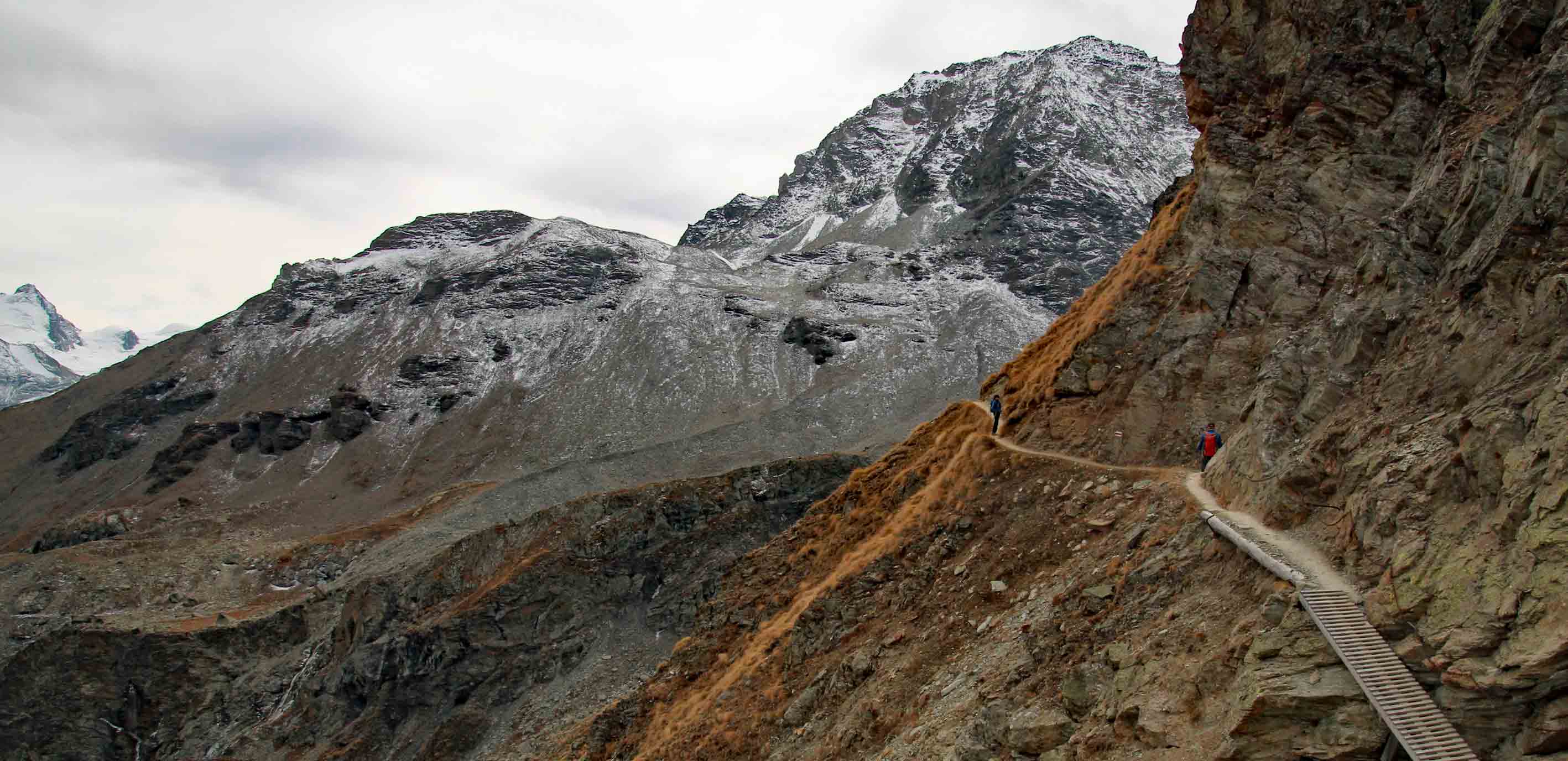
After Lac Bleu, continue along the trail to the Cabane des Aiguilles Rouges, perched at the top of the hanging valley behind the lake. The trail climbs up the right side of the valley before traversing the head and then climbing steeply again to the cabane.
After the cabane you descend a little then walk high along the main valley through a very rocky landscape. After around 1.4 km the trail forks. Stick to the trail to the left with the red and white markings, which takes you down to Arolla.


Difficult hike: Arolla – Lac Bleu – Cabane des Aiguilles Rouges – Col des Ignes – Pas de Chèvres – Arolla
Highest point: 3,181 m (Col des Ignes)
Height gain: +1,760 m/-1,760 m
Technical details: T3 – T4; high altitude; mostly a good trail but some rock scrambles; ladders in places
Distance: ∼23 km
For a longer and more difficult hike (which is what we did), turn right at the fork onto the track to Col des Ignes — the markings are blue and white. The trail takes you up the valley of the former Ignes glacier, of which not much remains. The last part up to the col is steep, and was also a little icy when we were there in late October. From the top — which is the highest point of the walk — you have a magnificent view of the Lac des Dix and Cheilon glacier on the other side.
The trail descends steeply from the col, then runs through a boulder field along the side of the valley for a 3-4 kilometers to the Pas de Chèvres. (Sorry I can’t be more precise, but James’ gpx tracking is a bit wonky). After an easy climb up a couple of ladders you’re back in the Val d’Hérens — and from here it’s a straightforward walk back to Arolla, on a good trail once again.


Hiking trail maps
(gpx download under the maps)